TARANTO ROMANA ENG
TARANTO IN THE ROMAN ERA
The port regained importance under Roman rule.
During this period, the moat was created where the navigation canal is today. Literary sources and archaeological finds make it possible to locate the port basin along the shore of the Mar Piccolo that runs from the moat to the small bay of S. Lucia (today used by the Military Arsenal).
But there was also a quay on the Mar Grande that was served by the Triglio aqueduct, which brought fresh water from the springs north of the city to supply the ships.
In 125 B.C. Taras became a Roman colony, under the name of Neptunia, and the Roman city took the Latin name of Tarentum.

The Triglio aqueduct, 2nd century B.C. - 16th century A.D.,(photo Sergio Malfatti)
THE TRIGLIO AQUEDUCT
It is a feat of engineering that brought water to Taranto from Roman times until the 19th century. The aqueduct is made up of a series of artificial underground tunnels and a surface section dating back to the post-Roman period, supported by arches that cross the municipalities of Crispiano, Statte and Taranto.
The aqueduct, built around the 1st century BC, after the founding of the colony Neptunia on the ruins of Taranto, supplied water to the villas on the outskirts of Taranto and not to its urban centre. The water system reached a quay on the Mar Grande to supply ships.
After the fall of the Roman Empire in 545, water for public use was also brought into the city at the behest of Totila, king of the Ostrogoths,
Restorations and extensions were carried out during the Byzantine period, then in the 14th century with funds from Catherine of Valois, then with the Aragonese (1469, the fountain in the Gran Piazza), and in 1543 (the arches commissioned by Charles V together with the monumental fountain).
FURTHER INFORMATION
The hydraulic system collected water from numerous springs in the Murge Tarantine hills. A dense network of underground tunnels, about 18 km long, poured the spring water into a large rocky cistern located at a depth of 9-10 m; from this, which acted as a collector, the main pipeline departed.
A WITNESS FROM THE SECOND CENTURY B.C. RECOUNTS
The Greek historian Polybius, who lived in the second century B.C., writes in Book 10 of his Histories about the importance of the port of Tarentum:
«The whole of the Italic coast from the strait and the city of Reggio to Tarentum for the length of 2000 stadia and more [over 320km], is completely devoid of ports, with the exception of the port of Tarentum which faces the sea of Sicily and looks towards the regions of Greece.“
POLYBIUS CONSIDERS TARANTO AND ITS SURROUNDING POPULATIONS
“That stretch of land is densely inhabited by barbarian peoples and boasts the most illustrious Greek cities: in it are found the Bruzi, the Lucani, part of the Dauni, the Calabrians and many other peoples. The Greek cities of Reggio, Locri, Caulonia, Crotone, Metaponto and Turi also occupy this coast. So whoever from Sicily and Greece is going to one of the above-mentioned places necessarily lands in the port of Taranto, and within this city take place all the exchanges and trades with the inhabitants of this region of Italy.”

The frontispiece of Polybius' Histories, Chap. 10, in a printing from 1751, tells of the port of Taranto in the 2nd century BC. (from Google Books)
THE ROMAN PORT AS DESCRIBED BY STRABO
Among the ancient literary accounts of the port of Taranto is that of Strabo, who wrote his Geography at the beginning of the 1st century, giving a detailed description of the port area of Taranto. In those days, the precious purple-dyed fabrics `{`Link to purple`}` so sought after by Roman aristocrats were shipped from here.
«While most of the gulf of Taranto is devoid of ports, in Taranto there is a very beautiful and wide harbour with a perimeter of 100 stadia [between 15 and 18km], enclosed by a large bridge. An isthmus is formed between the bottom of the harbour and the open sea, so that the city stands on a peninsula, and since the neck of the isthmus is not very high, ships can easily be hauled from one side to the other.».
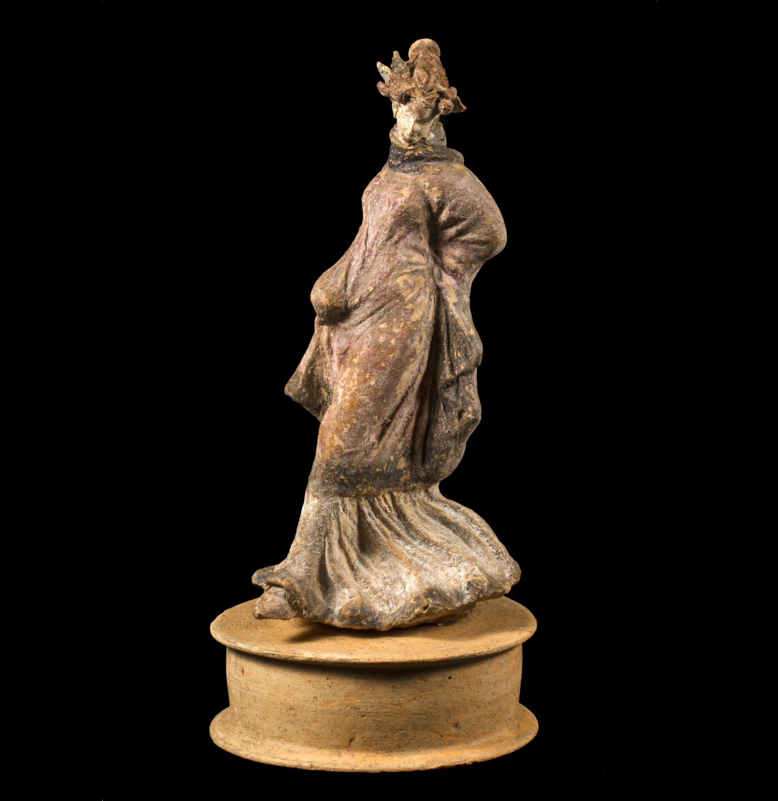
Figure of a dancer in polychromatic terracotta from 225-175 BC, found in Taranto, via G. Giovine, at the corner of via Marche, 1951. (photo MArTa)
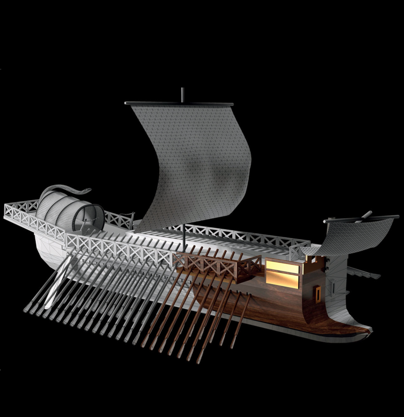
reconstruction of the Roman liburna at the port of Civitavecchia, created by Matteo Collina (from the website Civitavecchia.Portmobility.it)