
The different souls of a port
In different historical periods the port of Taranto has had a certain commercial and strategic importance. Starting from the Magna-Greek period up to the present day, it has shown its many faces: a commercial and industrial port, a place of welcome for tourists and migrants, a film set and a setting for sports events
Generous Curves
We are at the centre of the Mediterranean along the routes from the Suez Canal to Gibraltar, in a strategic position for traffic between East and West.
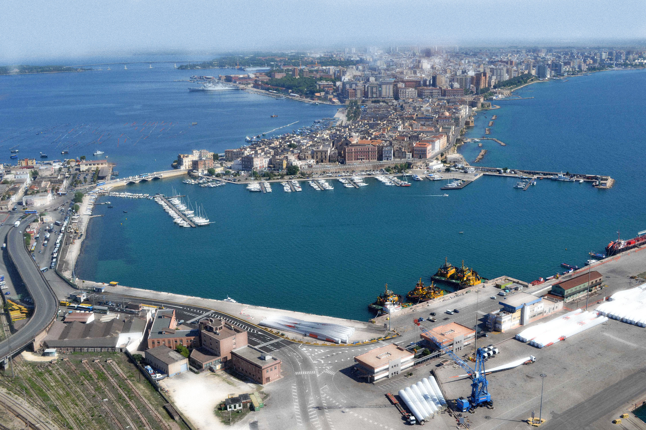
Among the most important ports in Italy for cargo handling, the port is located in the Gulf of Taranto, in the Mar Grande and immediately outside it.
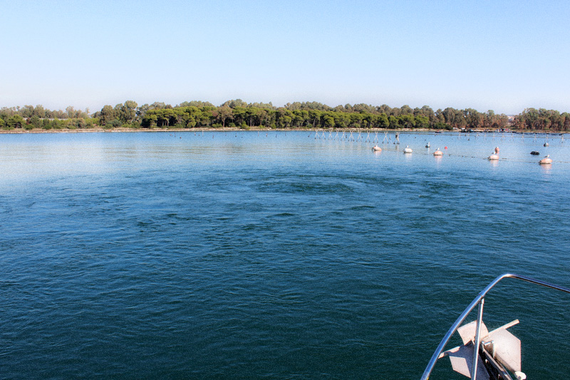
a port divided into different sectors: the commercial port, the industrial port and the tourist port. If the new city is situated on the mainland, the old one is on a small island with two seas around it: to the south-west, the Mar Grande bordered by the Chéradi islands, and to the north-east, the Mar Piccolo.
The latter, with a surface area of 20 square kilometres and a depth of about 14 metres, has underwater freshwater springs and three water courses: the Galeso, Cervaro and Rasca.
IN THE MEDITERRANEAN
The Taranto area lies on the Ionian Sea, on that coastline that geomorphologists call the Taranto Ionic Arch. It is the largest gulf in Italy, widening into a flat landscape.
On the coast to the west we find an extensive area with shoals and rocky outcrops, while to the east there is the wide expanse of the ‘Mar Grande’, which embraces the entire stretch from Punta Rondinella to Capo S. Vito. The southern side of the Gulf of Taranto is made up of the Ionian coasts of Calabria, to the north-west lies Basilicata, while the Apulian territory with the Salento peninsula stretches to the east.
WINDS, TIDES AND CURRENTS
The winds and tides, but also the underwater (freshwater) springs, influence the surface and deep currents in the two seas of Taranto and have played an important role for those who have sailed in these waters.
The strongest and most frequent winds are the Tramontana (from the north) and the Mistral (from the northwest), but the Libeccio (from the southwest) and those from the eastern (east and southeast) and southern sectors also arrive in Taranto.
The tides (both astronomical and those due to wind and atmospheric pressure) and tidal currents are modest: the sea level varies by about 10 to 20 cm.
Currents in the gulf, caused by differences in the density of the water, usually do not exceed 1 knot in speed and are parallel to the coast.
The Rose of the Winds (photo Sergio Malfatti)
The 'Rosa of the Winds' fountain designed by the architect Brunetti in honour of the city's seafaring tradition
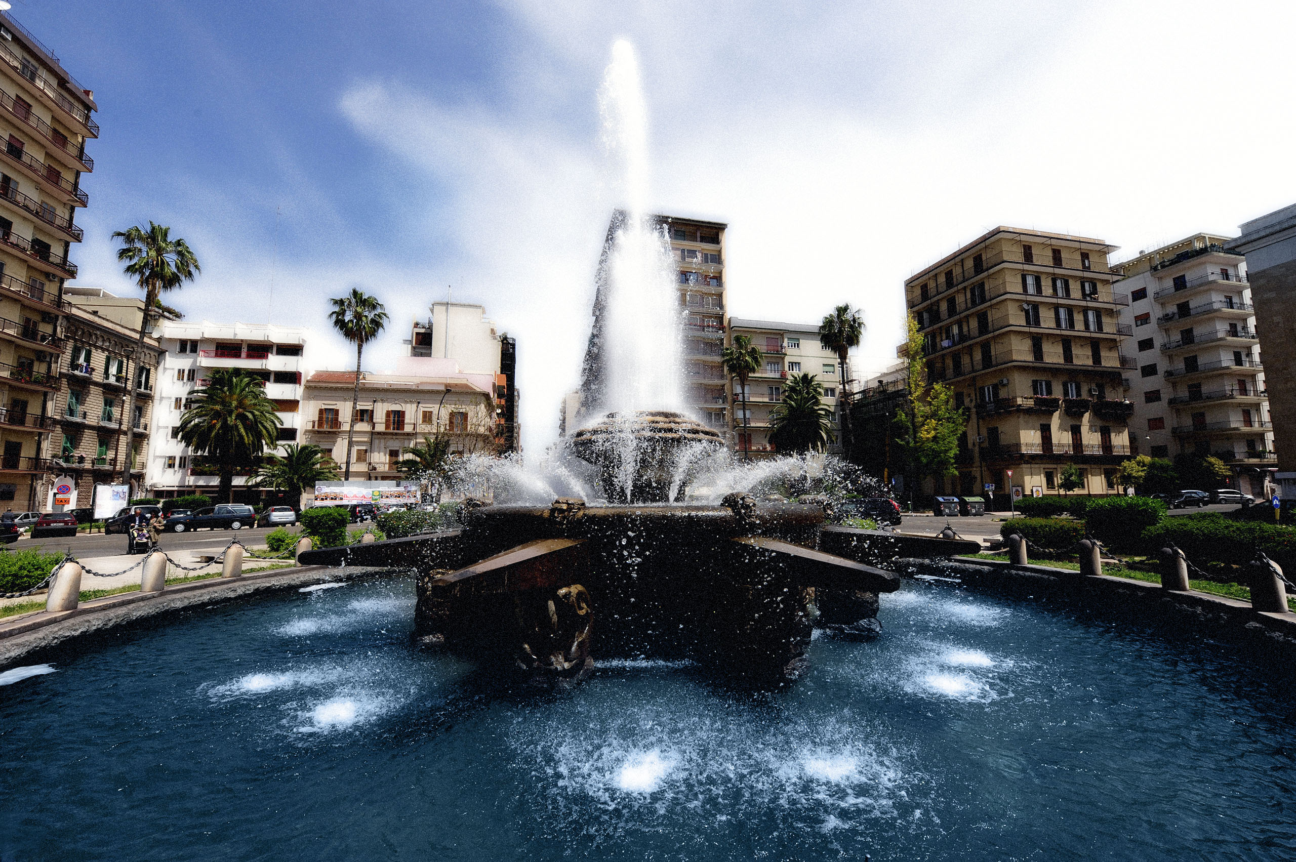
In April 1953 the fountain in Piazza Ebalia was inaugurated [Ebalia was the area from which Taranto expanded and its name derives from Ebalo, a legendary king of Sparta].
On the edge of the pool is a Latin inscription et adversis ventis impavide navigabimus (we will sail courageously even in adverse winds).
It's made like this
Puglia is the Italian region where soluble rocks, i.e. limestone that can dissolve in weakly acidic waters, appear most often.
But it is also the 'least Italian' of the regions due to the simplicity of its geological history.
GEOLOGICAL EVOLUTION
The geological history of Apulia and the Taranto area is linked to the evolution of the southern Apennines, which has depended in turn on the formation and expansion of the Mediterranean Sea.
Inland from Taranto and the Mar Piccolo we encounter a series of marine terraces that show us how much the topographical surface has risen over time and allow us to see in sequence the rocks that have stratified over the last 2.5 million years (Quaternary).
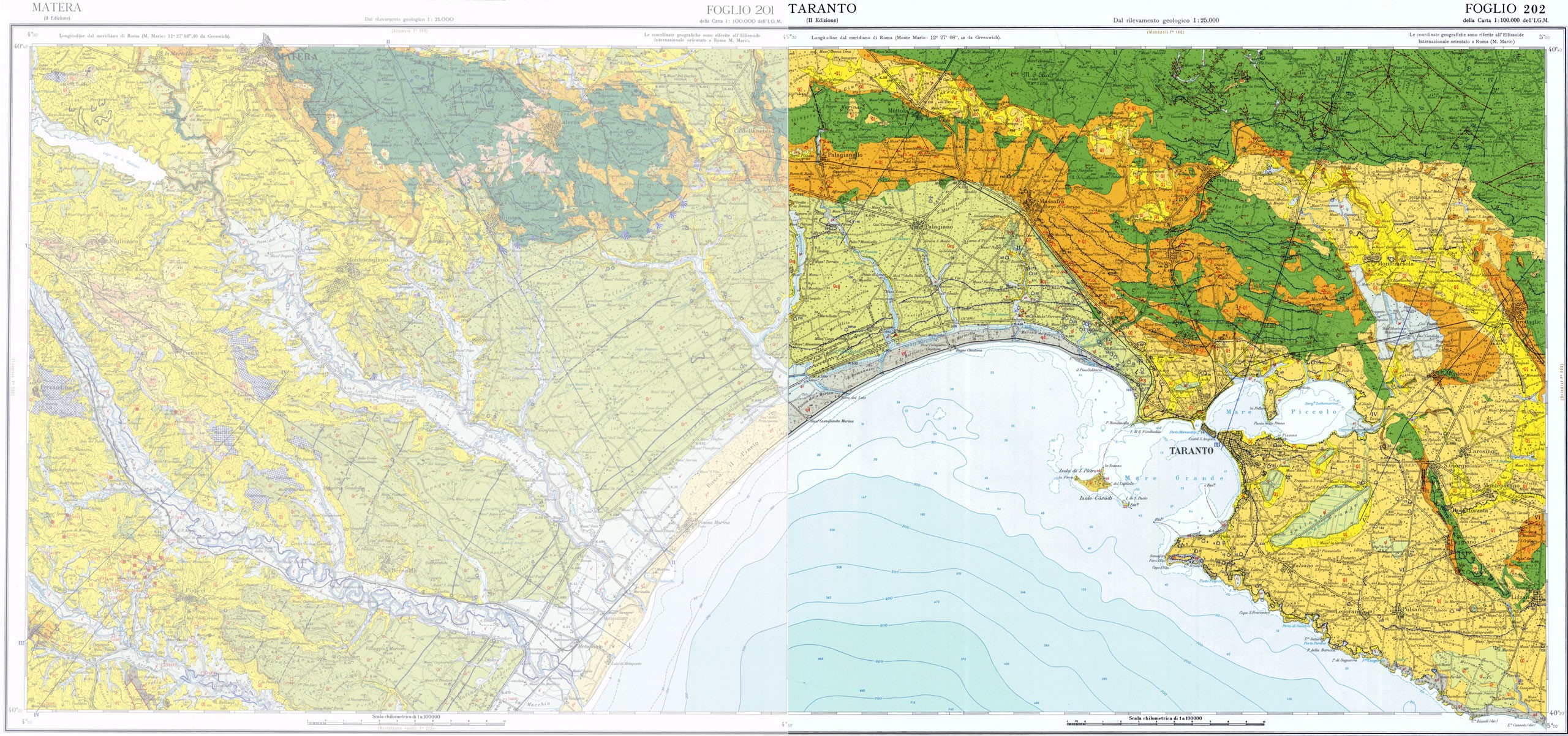
geological map of Taranto taken from: www.isprambiente.gov.it
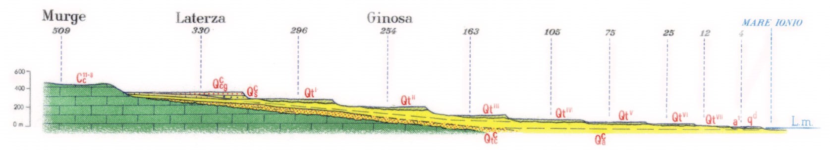
geological profile taken from: www.isprambiente.gov.it
RINGS OF SAINT CATALD
The limestone rock outcrops, formed in the Mesozoic Era (250 to 65 million years ago), appear in more than half of the territory, while the rest is buried under more recent layers.
Taranto is set within this landscape where karst phenomena are widespread, with caves, hollows and scarce surface water, while there are frequent freshwater springs along the coast or directly in the sea, known as “citri” or Saint Catald’s rings.
FRESH WATER SALT WATER
In Taranto, freshwater aquifers often end up in the sea (the “citri”), while salt sea water rises towards the interior, causing the salinisation of the aquifers.
We know of a deep aquifer, which circulates between the older limestone rocks (and has sea level as its basis) and a shallow aquifer, hosted by the recent sediments, which are arranged in terraces above the clays: these are impermeable and cover the bottom of the Bradanica Trench, the long depression that runs from the Molise border to Taranto.
DEEP AND SUPERFICIAL BASINS
The deep aquifer is plentiful because it is fed by a very large basin (it reaches the Murgia and the calcareous mountains of Basilicata), the superficial one is more limited because it is fed by a smaller basin that is affected by the seasonality of the rains.
The Apulia Region’s Water Protection Plan also shows the salinisation process of Taranto’s groundwater: at a depth of 50 m below sea level, we already reach salinity levels of over 3 g/l.
The “Citri”, image taken from... https://www.greenroutes.it/i-citri-35-miracoli-nei-due-mari-di-taranto